


Voting District 42261, Orange County, California
About
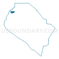
Outline

Summary
| Unique Area Identifier | 536300 |
| Name | Voting District 42261 |
| County | Orange County |
| State | California |
| Area (square miles) | 3.74 |
| Land Area (square miles) | 3.74 |
| Water Area (square miles) | 0.00 |
| % of Land Area | 100.00 |
| % of Water Area | 0.00 |
| Latitude of the Internal Point | 33.84377570 |
| Longtitude of the Internal Point | -118.00840930 |
Maps


Graphs
Select a template below for downloading or customizing gragh for Voting District 42261, Orange County, California


Neighbors
Neighoring Voting District (by Name) Neighboring Voting District on the Map
- Voting District 22516, Orange County, CA
- Voting District 22526, Orange County, CA
- Voting District 22541, Orange County, CA
- Voting District 22546, Orange County, CA
- Voting District 42246, Orange County, CA
- Voting District 42256, Orange County, CA
- Voting District 42266, Orange County, CA
- Voting District 42276, Orange County, CA
- Voting District 42281, Orange County, CA
- Voting District 42286, Orange County, CA
- Voting District 42296, Orange County, CA
- Voting District 42301, Orange County, CA
- Voting District 42311, Orange County, CA
- Voting District 42341, Orange County, CA
- Voting District 42531, Orange County, CA
- Voting District 42536, Orange County, CA
Top 10 Neighboring County Subdivision (by Population) Neighboring County Subdivision on the Map
Top 10 Neighboring Place (by Population) Neighboring Place on the Map
- Anaheim city, CA (336,265)
- Buena Park city, CA (80,530)
- Cypress city, CA (47,802)
- La Palma city, CA (15,568)
Top 10 Neighboring Elementary School District (by Population) Neighboring Elementary School District on the Map
- Anaheim Elementary School District, CA (196,615)
- Magnolia Elementary School District, CA (62,043)
- Centralia Elementary School District, CA (55,193)
- Buena Park Elementary School District, CA (47,854)
- Cypress Elementary School District, CA (43,516)
Top 10 Neighboring Secondary School District (by Population) Neighboring Secondary School District on the Map
- Anaheim Union High School District, CA (386,606)
- Fullerton Joint Union High School District, CA (249,728)
Top 10 Neighboring State Legislative District Lower Chamber (by Population) Neighboring State Legislative District Lower Chamber on the Map
- Assembly District 72, CA (449,140)
- Assembly District 67, CA (429,075)
- Assembly District 56, CA (425,338)
Top 10 Neighboring State Legislative District Upper Chamber (by Population) Neighboring State Legislative District Upper Chamber on the Map
Top 10 Neighboring 111th Congressional District (by Population) Neighboring 111th Congressional District on the Map
Top 10 Neighboring Census Tract (by Population) Neighboring Census Tract on the Map
- Census Tract 869.01, Orange County, CA (8,725)
- Census Tract 1102.02, Orange County, CA (7,762)
- Census Tract 1102.01, Orange County, CA (7,483)
- Census Tract 868.03, Orange County, CA (7,478)
- Census Tract 1103.01, Orange County, CA (6,729)
- Census Tract 1103.02, Orange County, CA (6,033)
- Census Tract 1101.02, Orange County, CA (5,780)
- Census Tract 1101.10, Orange County, CA (5,706)
- Census Tract 1104.02, Orange County, CA (5,459)
- Census Tract 1103.03, Orange County, CA (4,986)